

Key Takeaways
- Drone services can highlight your property’s unique features for standout listings.
- Understand costs, legalities, and ethical factors before choosing a Realtor with drone services.
When it’s time to sell your home, you want every advantage to stand out in a competitive market. Drone services are becoming a modern tool for home listings, offering new ways to showcase properties. Here’s what you should know when considering a Realtor who offers drone photography and footage.
What Are Realtor Drone Services?
Aerial photography explained
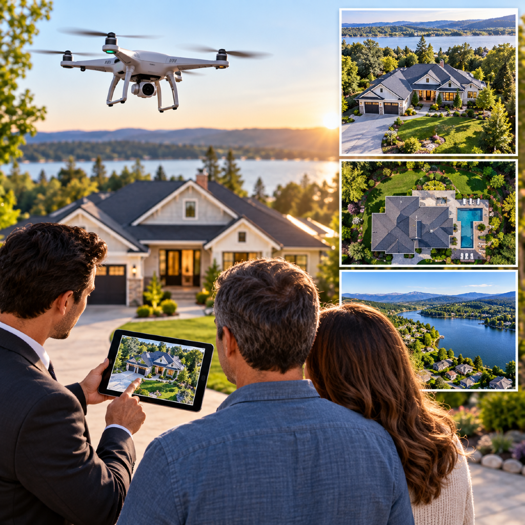
Aerial photography refers to images captured from above the property, typically using small, remote-controlled drones. These photos provide a unique “bird’s-eye view,” showing the layout of your home, the lot, and even surrounding amenities. Compared to traditional ground-level photos, aerial shots can make your listing look more expansive and dynamic.
How agents use drone footage
Realtors may use drone footage to create high-quality images or sweeping video tours. These visuals can be used in your online listings, social media marketing, and even virtual tours. Agents often highlight features such as landscaped yards, nearby parks, unique lot shapes, or scenic views—attributes that ground photos may miss. Drone services offer a comprehensive visual story to potential buyers.
How Can Drones Improve Listings?
Showcasing property features
Drones are especially useful for showcasing features that are difficult to capture from the ground. If your home has a large backyard, pool, garden, or outbuildings, aerial images present them together in relation to the house. Multi-story homes, custom architecture, and unique exterior upgrades also benefit from this wide-angle perspective. Drones let buyers see the entire property at once, making details easier to appreciate.
Highlighting location and surroundings
Beyond your property lines, drones highlight desirable surrounding features. Proximity to lakes, greenbelts, trails, or schools can be shown clearly. For homes with impressive views—such as cityscapes, mountains, or open land—aerial footage captures the setting in context. You’re able to show how your property fits into the larger neighborhood, helping buyers visualize their future lifestyle.
What Are the Costs and Considerations?
Potential fees to expect
Drone services may be included by some Realtors or come as an optional add-on, so costs can vary. You might see flat fees ranging from $100 to $400 per session, depending on the property size and complexity. Factors such as video production, editing, or additional stills may affect pricing. Always ask for a breakdown of what’s included before agreeing to these services.
Licensing and safety factors
Professional drone operations must follow local and federal guidelines. Operators should be properly licensed and only fly drones in legal airspace. There are rules about flying near airports, over people, and above a certain height. Safety protocols are in place to protect property, people, and privacy. Working with a Realtor who uses qualified drone operators ensures all flights are in compliance and minimizes risks during a photo shoot.
Are Drone Services Worth It for My Sale?
Best situations for drone photography
Drone imagery is especially impactful for larger homes, properties with unique features, or those in scenic locations. If your home sits on more than a quarter-acre, is near parks or waterfronts, or offers amenities buyers can’t see from the street, aerial views may give your listing a competitive edge. Homes in communities where nearly every listing has high-end photography may also benefit so yours remains visually competitive.
Alternatives to drone imagery
If drone services aren’t a good fit—due to costs, property type, or legal restrictions—consider enhanced ground-level photos or virtual staging. Professional twilight photography, neighborhood tours, or 3D walkthroughs can also appeal to buyers. The key is to highlight your property’s strengths using the technology that fits your situation and budget best.
How Do I Choose the Right Realtor?
Questions to ask during interviews
When interviewing potential Realtors, ask specific questions about drone service options:
- What is included in your standard listing package?
- Do you use licensed drone operators?
- How do you determine if my property will benefit from aerial photography?
- Are there any additional fees?
- Can I see sample drone listings?
These questions help you gauge how knowledgeable and prepared each agent is about drone compliance, costs, and overall value.
Evaluating experience and skills
Look for Realtors who can demonstrate experience working with drone photography—either directly or through partnerships. Review past listings for both photo quality and creative use of aerial footage. An agent’s ability to communicate the benefits, process, and regulations around drone use is an indicator of expertise and professionalism.
Do Drone Photos Affect Buyer Interest?
Recent trends and buyer preferences
Recent real estate trends indicate that buyers increasingly respond to rich, visual content. Listings with aerial photography may see more online views and longer engagement times. Many buyers appreciate being able to evaluate a property’s proximity to amenities or assess lot boundaries before visiting in person.
Limitations of drone imagery
While drone images add value, they may not be ideal for every listing. Weather, neighborhood privacy rules, or dense urban areas can limit their use. Additionally, most buyers still want clear, well-lit indoor photos to accompany any aerial footage. Drone imagery should be part of a balanced marketing package and not the sole focus.
What Are the Legal and Ethical Issues?
Privacy laws and airspace rules
Using drones for real estate means following privacy laws and airspace regulations. Generally, flights over private property should avoid capturing neighboring homes or yards without consent. Operators must respect airport zones and avoid restricted airspace. Ensuring your Realtor’s drone operator is properly licensed helps protect you from regulatory or liability issues.
Ethical use of real estate drones
Professional agents should use drone footage ethically—showcasing your property’s strengths without misrepresenting the setting or downplaying any material facts. Ethical use also means maintaining transparency with neighbors and respecting all local community guidelines.